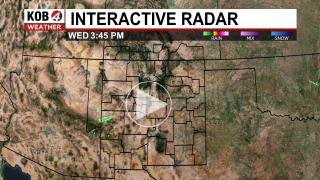
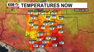
New Mexico Weather Alerts
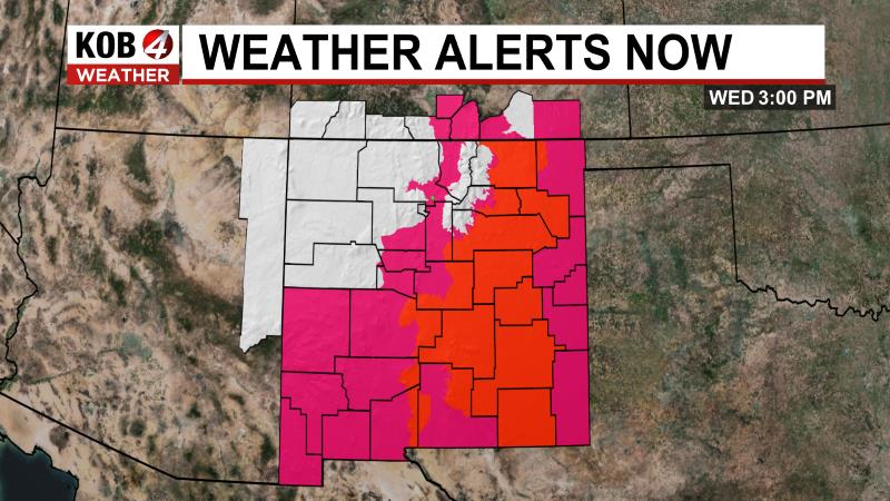
High Wind Watch (NM)
Issued: 2025-03-29 11:00 AM
Severity: Severe | Urgency: Future | Certainty: Possible
Areas Affected: Guadalupe Mountains of Eddy County; Guadalupe Mountains Above 7000 Feet; Guadalupe and Delaware Mountains
WHAT...West winds 35 to 45 mph with gusts up to 60 mph possible.
WHERE...Guadalupe Mountains of west Texas and Southeast New Mexico.
WHEN...From Saturday morning through Saturday evening.
IMPACTS...Travel will be difficult, especially for high profile vehicles like campers, vans, and tractor trailers. Severe turbulence near the mountains will be hazardous for low flying light aircraft.
Red Flag Warning (NM)
Issued: 2025-03-29 12:00 PM
Severity: Severe | Urgency: Expected | Certainty: Likely
Areas Affected: Southwest Deserts and Lowlands; South Central Lowlands And Southern Rio Grande Valley; Capitan And Sacramento Mountains; El Paso; Hudspeth
...CRITICAL FIRE WEATHER CONDITIONS FOR PORTIONS OF SOUTHERN NEW MEXICO AND WEST TEXAS ON SATURDAY... .Increasing west to southwesterly flow aloft will induce lee surface troughing east of the Rockies on Saturday afternoon. Breezy to windy conditions will result across southern New Mexico and Far West Texas. The winds, in combination with very low humidity, and critically dry fuels, will lead to critical fire weather conditions across a wide area Saturday afternoon.
AFFECTED AREA...Texas Fire Weather Zones 055 El Paso County, 056 Hudspeth County, New Mexico Fire Weather Zones 111 Southwest Deserts and Lowlands/Las Cruces BLM/GLZ, 112 South Central Lowlands and Southern Rio Grande Valley/BLM/GLZ and 113 Capitan and Sacramento Mountains/Lincoln NF/LNZ.
TIMING...Saturday from Noon through 8 PM MDT.
WINDS...West 20 to 25 mph with gusts up to 40 mph.
RELATIVE HUMIDITY...Afternoon minimum RH values 7 to 10 percent in the desert lowlands, 10 to 15 percent above 6000 feet, and 15 to 20 percent above 7500 feet.
EXPERIMENTAL RFTI...3 to 6 or Near-Critical to Critical.
IMPACTS...any fires that develop will likely spread rapidly. Outdoor burning is not recommended.
Red Flag Warning (NM)
Issued: 2025-03-29 1:00 PM
Severity: Severe | Urgency: Expected | Certainty: Likely
Areas Affected: Sacramento Foothills and Guadalupe Mountains; Chaves County Plains; Eddy Plains; Lea; Gaines; Dawson; Borden; Scurry; Andrews; Martin; Howard; Mitchell; Loving; Winkler; Ector; Midland; Glasscock; Ward; Guadalupe Mountains Above 7000 Feet; Guadalupe and Delaware Mountains; Van Horn and Highway 54 Corridor; Eastern Culberson County; Reeves County Plains; Davis Mountains; Davis Mountains Foothills
...FIRE WEATHER WATCH IN EFFECT SATURDAY AFTERNOON AND EVENING FOR 20 FOOT WINDS OF 20 MPH OR GREATER, RELATIVE HUMIDITY OF LESS THAN 15 PERCENT, AND EXTREME FIRE DANGER ACROSS SOUTHEAST NEW MEXICO, THE GUADALUPE AND DAVIS MOUNTAINS, MARFA PLATEAU, CULBERSON COUNTY AND UPPER TRANS PECOS, AND THE NORTHERN AND CENTRAL PERMIAN BASIN... The National Weather Service in Midland/Odessa has issued a Red Flag Warning for wind and low relative humidity, which is in effect from 1 PM CDT /noon MDT/ to 9 PM CDT /8 PM MDT/ Saturday. The Fire Weather Watch is no longer in effect.
WINDS...West 25 to 35 mph with gusts up to 50 mph.
RELATIVE HUMIDITY...As low as 7 percent.
RFTI...5 or critical.
IMPACTS...Avoid the use of open flames or any activities that may generate sparks. Extinguish smoking material in vehicles. Accidental ignitions will have the potential to grow into dangerous wind-driven wildfires.
SEVERITY... FUELS (ERC)...90th+ percentile...5 (out of 5). WEATHER...Critical...3 (out of 5). FIRE ENVIRONMENT...8 (out of 10).
Fire Weather Watch (NM)
Issued: 2025-03-30 1:00 PM
Severity: Severe | Urgency: Future | Certainty: Possible
Areas Affected: Central Highlands
...RED FLAG WARNING FROM 12 TO 8 PM MDT SATURDAY EAST OF THE SANGRE DE CRISTO MOUNTAINS, ALONG AND EAST OF THE SANDIA AND MANZANO MOUNTAINS, AND ACROSS WEST CENTRAL BASIN AND RANGE DUE TO GUSTY WINDS AND LOW HUMIDITY VALUES... ...FIRE WEATHER WATCH FROM 1 TO 7 PM MDT SUNDAY FOR THE CENTRAL HIGHLANDS DUE TO STRONG WIND AND LOW HUMIDITY... .A disturbance crossing the central Rockies will strengthen the flow aloft over New Mexico on Saturday, while a potent surface trough develops in the lee of the southern Rockies. As a result, southwest wind gusts are forecast to peak around 35 to 45 mph on Saturday afternoon with the strongest gusts along I-40 from Clines Corners to the Texas border and across far west central NM, including Gallup. These winds combined with minimum relative humidity values in the upper single digits to low teens and extremely dry fuels will result in rapid fire spread. In the wake of the disturbance, wind speeds will weaken briefly Saturday night, then strengthen again across the Central Highlands on Sunday, where rapid fire spread is once again possible. The National Weather Service in Albuquerque has upgraded the Fire Weather Watch to Red Flag Warning...which is in effect from noon to 8 PM MDT Saturday. The Fire Weather Watch from 1 PM to 7 PM MDT Sunday remains in effect.
AREA AND TIMING...Central Highlands (Zone 125) from 12-8 PM Saturday and from 1-7 PM Sunday.
20 FOOT WINDS...Southwest 20 to 35 mph with gusts up to 45 mph both afternoons.
RELATIVE HUMIDITY...10-12 percent Saturday, then 10-14 percent Sunday.
IMPACTS...Any fires that develop will likely spread rapidly. Outdoor burning is not recommended.
Red Flag Warning (NM)
Issued: 2025-03-29 12:00 PM
Severity: Severe | Urgency: Expected | Certainty: Likely
Areas Affected: Northeast Plains; West Central Mountains; West Central Basin and Range; Northeast Highlands; Sandia and Manzano Mountains; East Central Plains
...RED FLAG WARNING FROM 12 TO 8 PM MDT SATURDAY EAST OF THE SANGRE DE CRISTO MOUNTAINS, ALONG AND EAST OF THE SANDIA AND MANZANO MOUNTAINS, AND ACROSS WEST CENTRAL BASIN AND RANGE DUE TO GUSTY WINDS AND LOW HUMIDITY VALUES... ...FIRE WEATHER WATCH FROM 1 TO 7 PM MDT SUNDAY FOR THE CENTRAL HIGHLANDS DUE TO STRONG WIND AND LOW HUMIDITY... .A disturbance crossing the central Rockies will strengthen the flow aloft over New Mexico on Saturday, while a potent surface trough develops in the lee of the southern Rockies. As a result, southwest wind gusts are forecast to peak around 35 to 45 mph on Saturday afternoon with the strongest gusts along I-40 from Clines Corners to the Texas border and across far west central NM, including Gallup. These winds combined with minimum relative humidity values in the upper single digits to low teens and extremely dry fuels will result in rapid fire spread. In the wake of the disturbance, wind speeds will weaken briefly Saturday night, then strengthen again across the Central Highlands on Sunday, where rapid fire spread is once again possible. The National Weather Service in Albuquerque has upgraded the Fire Weather Watch to a Red Flag Warning...which is in effect from noon to 8 PM MDT Saturday.
AREA AND TIMING...Northeast Highlands and eastern plains (Zones 123, 104, and 126), Sandia and Manzano Mountains (Zone 124), and the West Central Mountains, Basin, and Range (Zones 105 and 109) Saturday 12-8 PM.
20 FOOT WINDS...Southwest 20 to 35 mph with gusts up to 45 mph.
RELATIVE HUMIDITY...9-15 percent.
IMPACTS...Any fires that develop will likely spread rapidly. Outdoor burning is not recommended..
Red Flag Warning (NM)
Issued: 2025-03-29 12:00 PM
Severity: Severe | Urgency: Expected | Certainty: Likely
Areas Affected: Central Highlands
...RED FLAG WARNING FROM 12 TO 8 PM MDT SATURDAY EAST OF THE SANGRE DE CRISTO MOUNTAINS, ALONG AND EAST OF THE SANDIA AND MANZANO MOUNTAINS, AND ACROSS WEST CENTRAL BASIN AND RANGE DUE TO GUSTY WINDS AND LOW HUMIDITY VALUES... ...FIRE WEATHER WATCH FROM 1 TO 7 PM MDT SUNDAY FOR THE CENTRAL HIGHLANDS DUE TO STRONG WIND AND LOW HUMIDITY... .A disturbance crossing the central Rockies will strengthen the flow aloft over New Mexico on Saturday, while a potent surface trough develops in the lee of the southern Rockies. As a result, southwest wind gusts are forecast to peak around 35 to 45 mph on Saturday afternoon with the strongest gusts along I-40 from Clines Corners to the Texas border and across far west central NM, including Gallup. These winds combined with minimum relative humidity values in the upper single digits to low teens and extremely dry fuels will result in rapid fire spread. In the wake of the disturbance, wind speeds will weaken briefly Saturday night, then strengthen again across the Central Highlands on Sunday, where rapid fire spread is once again possible. The National Weather Service in Albuquerque has upgraded the Fire Weather Watch to Red Flag Warning...which is in effect from noon to 8 PM MDT Saturday. The Fire Weather Watch from 1 PM to 7 PM MDT Sunday remains in effect.
AREA AND TIMING...Central Highlands (Zone 125) from 12-8 PM Saturday and from 1-7 PM Sunday.
20 FOOT WINDS...Southwest 20 to 35 mph with gusts up to 45 mph both afternoons.
RELATIVE HUMIDITY...10-12 percent Saturday, then 10-14 percent Sunday.
IMPACTS...Any fires that develop will likely spread rapidly. Outdoor burning is not recommended.
Fire Weather Watch (NM)
Issued: 2025-03-29 1:00 PM
Severity: Severe | Urgency: Past | Certainty: Observed
Areas Affected: Northeast Plains; West Central Mountains; West Central Basin and Range; Northeast Highlands; Sandia and Manzano Mountains; East Central Plains
The Fire Weather Watch has been replaced. Please see the latest information from NWS Albuquerque NM on this developing situation.
Fire Weather Watch (NM)
Issued: 2025-03-29 1:00 PM
Severity: Severe | Urgency: Past | Certainty: Observed
Areas Affected: Central Highlands
The Fire Weather Watch has been replaced. Please see the latest information from NWS Albuquerque NM on this developing situation.