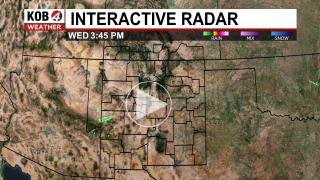
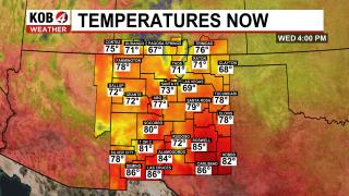
New Mexico Weather Alerts
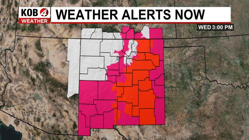
Fire Weather Watch (NM)
Issued: 2025-04-18 10:00 AM
Severity: Severe | Urgency: Future | Certainty: Possible
Areas Affected: Sacramento Foothills and Guadalupe Mountains; Chaves County Plains; Eddy Plains; Lea; Gaines; Andrews; Loving; Winkler; Ward; Guadalupe Mountains Above 7000 Feet; Guadalupe and Delaware Mountains; Van Horn and Highway 54 Corridor; Eastern Culberson County; Reeves County Plains; Davis Mountains; Davis Mountains Foothills
...RED FLAG WARNING IN EFFECT THIS AFTERNOON AND EVENING FOR 20- FT WINDS OF 20 MPH OR MORE, RELATIVE HUMIDITY OF 15% OR LESS, AND VERY HIGH TO EXTREME FIRE DANGER FOR SOUTHEAST NEW MEXICO, NORTHWEST PERMIAN BASIN AND HIGHER TERRAIN... ...FIRE WEATHER WATCH IN EFFECT FRIDAY AFTERNOON AND EVENING FOR 20-FT WINDS OF 20 MPH OR MORE, RELATIVE HUMIDITY OF 15% OR LESS, AND VERY HIGH TO EXTREME FIRE DANGER FOR SOUTHEAST NEW MEXICO, NORTHWEST PERMIAN BASIN AND HIGHER TERRAIN... ...FIRE WEATHER WATCH REMAINS IN EFFECT FROM FRIDAY MORNING THROUGH FRIDAY EVENING FOR 20-FT WINDS OF 20 MPH OR MORE, RELATIVE HUMIDITY OF 15% OR LESS, AND VERY HIGH TO EXTREME FIRE DANGER SOUTHEAST NEW MEXICO, NORTHWEST PERMIAN BASIN AND HIGHER TERRAIN...
WINDS...Southwest 25 to 35 mph with gusts up to 55 mph. Higher winds expected in the mountains.
RELATIVE HUMIDITY...As low as 8 percent.
RFTI...7 or extreme.
IMPACTS...Avoid the use of open flames or any activities that may generate sparks. Accidental ignitions will have the potential to grow into dangerous wind-driven wildfires. Fires can start from the smallest of flames or sparks and are highly discouraged. Observe local burn bans.
SEVERITY... FUELS (ERC)...70th-89th percentile...4 (out of 5). WEATHER...Critical...3 (out of 5). FIRE ENVIRONMENT...7 (out of 10).
Fire Weather Watch (NM)
Issued: 2025-04-18 12:00 PM
Severity: Severe | Urgency: Past | Certainty: Observed
Areas Affected: Middle Rio Grande Valley; Northeast Highlands; Sandia and Manzano Mountains; Central Highlands; East Central Plains
The Fire Weather Watch has been replaced. Please see the latest information from NWS Albuquerque NM on this developing situation.
Red Flag Warning (NM)
Issued: 2025-04-18 12:00 PM
Severity: Severe | Urgency: Expected | Certainty: Likely
Areas Affected: Southwest Deserts and Lowlands; South Central Lowlands And Southern Rio Grande Valley; Capitan And Sacramento Mountains; El Paso; Hudspeth
...CRITICAL TO EXTREME FIRE WEATHER FOR SOUTHERN NEW MEXICO AND FAR WEST TEXAS ON FRIDAY... Windy conditions will combine with single-digit lowland minimum RH values with only the highest elevations seeing minimum RH values in the teens. When combined with very dry fuels, critical to extreme fire weather conditions are expected for Friday afternoon.
AFFECTED AREA...Texas fire zones 55 and 56, which includes El Paso and Hudspeth counties. Also, New Mexico fire zones 110, 111, 112, and 113, which includes Hidalgo, Grant, Luna, Dona Ana, Sierra, and Otero counties.
TIMING...From noon to 8 PM on Friday.
WINDS...Southwest 20 to 25 mph with gusts 40 to 45 mph.
RELATIVE HUMIDITY...as 5 to 10 percent Thursday, 8 to 12 percent Friday.
EXPERIMENTAL RFTI...5 to 9 or Critical to Extreme on Thursday. 3 to 7 Elevated to Critical on Friday.
IMPACTS...any fires that develop will likely spread rapidly. Outdoor burning is not recommended.
Red Flag Warning (NM)
Issued: 2025-04-18 12:00 PM
Severity: Severe | Urgency: Expected | Certainty: Likely
Areas Affected: Middle Rio Grande Valley; Northeast Highlands; Sandia and Manzano Mountains; Central Highlands; East Central Plains
...RED FLAG WARNING IN EFFECT FROM NOON TO 7 PM MDT FRIDAY FOR PORTIONS OF CENTRAL AND EASTERN NEW MEXICO DUE TO GUSTY WINDS, LOW HUMIDITY, AND HIGH FIRE DANGER... .Locally elevated to critical fire weather conditions may continue through the late evening for a few areas. Critical fire weather conditions will redevelop on Friday around noon across much of central and eastern NM as strong southwest winds and low humidity persist.
AREA AND TIMING...This includes the Northeast Highlands (Zone 123), Middle Rio Grande Valley (Zone 106), Sandia and Manzano Mountains (Zone 124), Central Highlands (Zone 125) and East Central Plains (Zone 126).
20 FOOT WINDS...Southwest winds 20 to 30 mph with gusts up to 45 mph on Friday.
RELATIVE HUMIDITY...Minimum values 9 to 14 percent on Friday.
IMPACTS...Any fires that develop will likely spread rapidly. Outdoor burning is not recommended.
Winter Storm Watch (NM)
Issued: 2025-04-18 6:00 PM
Severity: Severe | Urgency: Future | Certainty: Possible
Areas Affected: Chuska Mountains; Tusas Mountains Including Chama; Jemez Mountains; Northern Sangre de Cristo Mountains; Southern Sangre de Cristo Mountains; East Slopes Sangre de Cristo Mountains; Johnson and Bartlett Mesas Including Raton Pass
WHAT...Heavy snow possible. Total snow accumulations between 3 and 9 inches except up to 12 inches above 9000 feet possible.
WHERE...Northern Mountains, Chuska Mountains, and Johnson and Bartlett Mesas Including Raton Pass.
WHEN...From Friday evening through Saturday evening.
IMPACTS...Travel could be very difficult. Tire chains may be necessary if traveling through mountain passes. The hazardous conditions could impact the Friday evening commute.
High Wind Warning (NM)
Issued: 2025-04-18 1:21 AM
Severity: Severe | Urgency: Expected | Certainty: Likely
Areas Affected: Guadalupe Mountains of Eddy County; Guadalupe Mountains Above 7000 Feet; Guadalupe and Delaware Mountains
WHAT...Southwest winds 30 to 50 mph with gusts up to 70 mph.
WHERE...Guadalupe Mountains of west Texas and Southeast New Mexico.
WHEN...Until midnight MDT /1 AM CDT/ tonight.
IMPACTS...Travel will be difficult, especially for high profile vehicles like campers, vans, and tractor trailers. Aviation interests may experience localized but extreme turbulence, or strong downward airflows if flying in the near the Guadalupe Mountains.
Wind Advisory (NM)
Issued: 2025-04-18 10:00 AM
Severity: Moderate | Urgency: Expected | Certainty: Likely
Areas Affected: Chaves County Plains
WHAT...Southwest winds 30 to 35 mph with gusts up to 55 mph expected.
WHERE...Chaves County Plains.
WHEN...From 10 AM to 7 PM MDT Friday.
IMPACTS...Gusty winds will blow around unsecured objects. Tree limbs may be blown down. Expect strong crosswinds on area roadways.
ADDITIONAL DETAILS...Blowing dust may limit visibility below three miles at times.
Wind Advisory (NM)
Issued: 2025-04-18 10:00 AM
Severity: Moderate | Urgency: Expected | Certainty: Likely
Areas Affected: Upper Tularosa Valley; South Central Mountains; Eastern Lincoln County; Southwest Chaves County
WHAT...Southwest winds 25 to 35 mph with gusts up to 55 mph expected.
WHERE...Eastern Lincoln County, South Central Mountains, Upper Tularosa Valley, and Southwest Chaves County.
WHEN...From 10 AM to 7 PM MDT Friday.
IMPACTS...Gusty winds will blow around unsecured objects. Tree limbs may be blown down. Expect strong crosswinds on area roadways.
Blowing Dust Advisory (NM)
Issued: 2025-04-18 11:00 AM
Severity: Moderate | Urgency: Expected | Certainty: Likely
Areas Affected: Lowlands of the Bootheel; Southwest Desert/Mimbres Basin; Northern Dona Ana County; Southern Dona Ana County/Mesilla Valley; West Slopes Sacramento Mountains Below 7500 Feet; Sacramento Mountains Above 7500 Feet; East Slopes Sacramento Mountains Below 7500 Feet; Otero Mesa; West Central Tularosa Basin/White Sands; East Central Tularosa Basin/Alamogordo; Southeast Tularosa Basin; Western El Paso County; Eastern/Central El Paso County; Northern Hudspeth Highlands/Hueco Mountains; Salt Basin
WHAT...For the Blowing Dust Advisory, visibility between one- quarter and one mile in blowing dust. For the Wind Advisory, southwest winds 25 to 35 mph with gusts up to 50 mph expected.
WHERE...In New Mexico, Northern Dona Ana County, Southeast Tularosa Basin, Southern Dona Ana County/Mesilla Valley, Lowlands of the Bootheel, and Southwest Desert/Mimbres Basin. In Texas, Eastern/Central El Paso County and Western El Paso County.
WHEN...From 11 AM to 8 PM MDT Friday.
IMPACTS...Hazardous driving conditions due to reduced visibility. Gusty winds will blow around unsecured objects. Tree limbs could be blown down and a few power outages may result.
Blowing Dust Advisory (NM)
Issued: 2025-04-18 11:00 AM
Severity: Moderate | Urgency: Expected | Certainty: Likely
Areas Affected: Southwest Desert/Lower Gila River Valley
WHAT...Visibility between one-quarter and one mile in blowing dust expected.
WHERE...Southwest Desert/Lower Gila River Valley.
WHEN...From 11 AM to 8 PM MDT Friday.
IMPACTS...Hazardous driving conditions due to reduced visibility. Gusty winds will blow around unsecured objects. Tree limbs could be blown down and a few power outages may result.
Wind Advisory (NM)
Issued: 2025-04-18 11:00 AM
Severity: Moderate | Urgency: Expected | Certainty: Likely
Areas Affected: Lowlands of the Bootheel; Southwest Desert/Mimbres Basin; Northern Dona Ana County; Southern Dona Ana County/Mesilla Valley; West Slopes Sacramento Mountains Below 7500 Feet; Sacramento Mountains Above 7500 Feet; East Slopes Sacramento Mountains Below 7500 Feet; Otero Mesa; West Central Tularosa Basin/White Sands; East Central Tularosa Basin/Alamogordo; Southeast Tularosa Basin; Western El Paso County; Eastern/Central El Paso County; Northern Hudspeth Highlands/Hueco Mountains; Salt Basin
WHAT...For the Blowing Dust Advisory, visibility between one- quarter and one mile in blowing dust. For the Wind Advisory, southwest winds 25 to 35 mph with gusts up to 50 mph expected.
WHERE...In New Mexico, Northern Dona Ana County, Southeast Tularosa Basin, Southern Dona Ana County/Mesilla Valley, Lowlands of the Bootheel, and Southwest Desert/Mimbres Basin. In Texas, Eastern/Central El Paso County and Western El Paso County.
WHEN...From 11 AM to 8 PM MDT Friday.
IMPACTS...Hazardous driving conditions due to reduced visibility. Gusty winds will blow around unsecured objects. Tree limbs could be blown down and a few power outages may result.
Wind Advisory (NM)
Issued: 2025-04-18 11:00 AM
Severity: Moderate | Urgency: Expected | Certainty: Likely
Areas Affected: Uplands of the Bootheel; Sierra County Lakes
WHAT...Wind Advisory, southwest winds 25 to 35 mph with gusts up to 60 mph expected.
WHERE...Uplands of the Bootheel.
WHEN...From 11 AM to 8 PM MDT Friday.
IMPACTS...Gusty winds will blow around unsecured objects. Tree limbs could be blown down and a few power outages may result.
Wind Advisory (NM)
Issued: 2025-04-18 1:21 AM
Severity: Moderate | Urgency: Expected | Certainty: Likely
Areas Affected: Eddy County Plains; Northern Lea County; Central Lea County; Southern Lea County; Van Horn and Highway 54 Corridor; Eastern Culberson County
WHAT...Southwest winds 25 to 35 mph with gusts up to 55 mph.
WHERE...Southeast New Mexico plains, Van Horn and Highway 54 Corridor, and Eastern Culberson.
WHEN...Until 7 PM MDT /8 PM CDT/ this evening.
IMPACTS...Gusty winds may blow around unsecured objects.